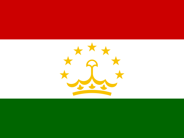
Tajikistan overview
Tajikistan lies in Central Asia, part of Asia. Treaties and official documents call it Republic of Tajikistan. Its seat of government is Dushanbe.
It covers 143,100 km², which ranks it 97th of the 250 countries and territories in this dataset — just behind Nepal and just ahead of Greece. For scale, it is almost exactly the same size as Nepal.
It is home to roughly 10.6 million people, placing it 91st of 250 by population — between Portugal above it and Papua New Guinea below. Within Central Asia alone it is the 5th largest of 5 and the 3rd most populous.
How Tajikistan reaches the sea
Tajikistan has no coastline of its own, so every ship-borne import and export crosses somebody else's border first. The good news is that the sea is only one frontier away: China has coastline, which makes it the natural gateway for freight heading to a port.
That geography has practical consequences. Landlocked countries carry higher freight costs than coastal ones because goods change hands, transport mode and jurisdiction more often, and because a neighbour's road, rail or customs problem becomes Tajikistan's problem too. It is also why transit agreements with bordering states, and access to their ports, tend to matter more in Tajikistan's foreign policy than the distance on a map would suggest.
Of the countries on Tajikistan's borders, Afghanistan, Kyrgyzstan and Uzbekistan are landlocked as well, so a route in that direction only moves the problem along. The remaining borders are the ones that lead, eventually, to salt water.
Coastal countries on the border:
Tajikistan and its neighbours, side by side
Tajikistan has 4 land neighbours, and together they hold 1,495,206,219 people — about 141 times Tajikistan's own population. Sharing a frontier with that much weight on the other side shapes trade, migration and language in ways the map alone does not show.
| Neighbour | Population | Area (km²) | vs Tajikistan by area |
|---|---|---|---|
| China | 1,408,975,000 | 9,706,961 | 68× larger |
| Afghanistanlandlocked | 42,647,492 | 652,230 | 4.6× larger |
| Uzbekistanlandlocked | 36,361,859 | 447,400 | 3.1× larger |
| Kyrgyzstanlandlocked | 7,221,868 | 199,951 | 1.4× larger |
By area the largest neighbour is China and the smallest is Kyrgyzstan; by population China is the heaviest presence on the border. Taken together the neighbours hold more people than Tajikistan does, which is the usual situation for a country with several borders and rarely a comfortable one.
Tajikistan at a glance
- Capital
- Dushanbe
- Population
- 10,590,927
- Area
- 143,100 km²
- Region
- Central Asia, Asia
- Languages
- Russian, Tajik
- Currency
- Tajikistani somoni (TJS)
- Calling code
- +992
- Internet TLD
- .tj
- People per km²
- 74
The lie of the land
Plotted on a globe it falls at 39.0° north, 71.0° east, which puts it in the northern hemisphere, roughly 4,341 km from the equator, in what geographers would call temperate latitudes.
Follow that same latitude east or west and you reach the United States, Türkiye and Spain — places that share its distance from the equator but little else.
4 countries share a land border with it: Afghanistan, China, Kyrgyzstan and Uzbekistan. The largest of them by area is China, which is also the most populous. Together those neighbours hold about 1.50 billion people.
This is one of the world's landlocked countries. That is true of 45 of the 250 entries here, which reliably raises the cost of trade, because port access depends on a transit agreement with a neighbour. 3 of its neighbours, Afghanistan, Kyrgyzstan and Uzbekistan, are landlocked too. You can see the full picture on the landlocked countries page.
Where Tajikistan is on the map
The map below is centred on Tajikistan at roughly 39.00°, 71.00°. Pan and zoom to see how it sits against its surroundings — the shape of a country's borders explains a surprising amount about its history.
Map data © OpenStreetMap contributors
The people of Tajikistan
Density comes out at around 74 people per square kilometre, which makes it less crowded than the typical entry on this list. Half the entries in this dataset fall below roughly 90 per square kilometre.
People from Tajikistan are called Tadzhiks.
Officially it is multilingual, listing Russian and Tajik. Tajik is listed for no other entry in this dataset, which makes it effectively unique to Tajikistan. Russian, the first listed, is shared with 7 other entries worldwide.
Against Asia as a whole it is the 29th most populous of 50 entries, and it accounts for 13% of everyone living in Central Asia.
Tajikistan within Central Asia
Zoom in from the world to Central Asia and Tajikistan sits 3rd of 5 by population and 5th by area. Its immediate company in that ordering is Kazakhstan just above and Turkmenistan just below, which is a more honest comparison set than a global league table.
Uzbekistan is the largest of the group by population, and every entry in Central Asia has its own page here if you want to work through the whole neighbourhood rather than one country at a time.
Money, codes and practical details
It uses the Tajikistani somoni (ЅМ, TJS). No other entry in this dataset uses it, so the currency is specific to Tajikistan.
The top-level domain is .tj. To phone it from abroad you dial +992. Its ISO codes are tj and TJK, which is what most databases and flag files use.
Dushanbe is the city to remember for this country.
It holds a seat at the United Nations, one of 193 entries here that do. The other 57 entries are territories, dependencies or observers, which is why totals on this site run to 250 rather than the familiar 195.
Money and language in Tajikistan
The Tajikistani somoni (TJS) is used only in Tajikistan among the 250 entries on this site. Its own currency is one of the clearest markers of an economy that sets its own monetary policy rather than importing somebody else's.
Language reaches wider still. Russian is listed for 8 entries here, Tajikistan among them, so a visitor who speaks it can be understood across a large part of the map. Shared language tends to outlive the empires, trade routes and migrations that spread it, which is why the linguistic map and the political one rarely line up.
Also lists Russian among its languages:
Fun facts about Tajikistan
- Its capital city is Dushanbe.
- It lies about 4,341 km from the equator, in temperate latitudes.
- Population density works out at roughly 74 people per square kilometre.
- The United States and Türkiye sit at almost the same latitude, on the far side of the globe.
- Tajik is listed as an official language for no other entry in this dataset.
- In land area it is almost exactly the same size as Nepal.
Tajikistan — frequently asked questions
- What is the capital of Tajikistan?
- The capital of Tajikistan is Dushanbe.
- How big is Tajikistan?
- Tajikistan covers 143,100 km², ranking 97th of 250 by land area. That makes it almost exactly the same size as Nepal.
- What language is spoken in Tajikistan?
- Tajikistan lists 2 official languages: Russian and Tajik. Tajik does not appear as an official language anywhere else in this dataset.
- Is Tajikistan a country?
- Yes. Tajikistan is a sovereign state and one of the 193 UN members listed on this site.
- Is Tajikistan landlocked?
- Yes. Tajikistan has no sea coast, which makes it one of 45 landlocked entries in this dataset. Everything it imports or exports by sea has to cross a neighbour's territory first, and that transit dependency is a well-documented drag on trade costs.
- Where is Tajikistan located?
- Tajikistan is in Central Asia, part of Asia. Its reference coordinates are 39.0° north and 71.0° east, roughly 4,341 km from the equator in temperate latitudes.
- Which countries border Tajikistan?
- Tajikistan borders 4 countries: Afghanistan, China, Kyrgyzstan and Uzbekistan. China is the largest of them by area.
- What currency does Tajikistan use?
- Tajikistan uses the Tajikistani somoni, written ЅМ (currency code TJS). No other entry in this dataset uses it.
- What is the population of Tajikistan?
- Tajikistan has a population of about 10.6 million, which makes it the 91st most populous of the 250 countries and territories listed on this site. Portugal sits just above it and Papua New Guinea just below.